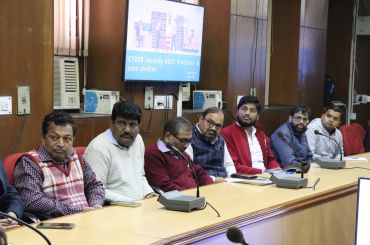
Evaluating Bus Rapid Transit (BRT) Corridor Performance from Amebedkar Nagar to Mool Chand Intersection
The recent growth in economic activity and average incomes have resulted in increased mobility and motorization in the metropolitan cities of India with Delhi leading the pack. To address the increased need for transport infrastructure and services, Government of National Capital Territory of Delhi (GNCTD) has launched several infrastructure projects, including the construction of a metro system, Bus Rapid Transit System (BRTS), new roads and flyovers. The BRTS initiative undertaken by GNCTD was realized as a pilot project (spanning for 5.8 Km) on April 20th 2008 and this BRTS stretch starts from the junction of signal-controlled Mehrauli - Badarpur Road (near Ambedkar Nagar) and runs on J. B. Tito Marg in South Delhi and ultimately terminating before Mool Chand Hospital Intersection on the Inner Ring Road. This study is in response to the Public Interest Litigation (PIL) Case filed by M/s. Nyaya Bhoomi, versus Government of NCT of Delhi, as the Honourable High Court, Delhi had passed the order directing the Transport Department, GNCTD for carrying out an evaluation of the BRTS corridor and to report to the Honourable High Court.
At the instance of the above Court Order, the Transport Department, GNCTD had requested CSIR-Central Road Research Institute (CRRI), New Delhi to undertake the study towards the evaluation of the BRTS corridor conforming to the Terms of Reference (TOR) prepared by Transport Department, GNCTD. Complying with the request of Transport Department, GNCTD and the Court order, CSIR-CRRI study team carried out an exhaustive list of studies on the BRT corridor and selected traffic studies on other adjoining Non-BRTS road sections in Delhi. The studies conducted include intersection traffic volume counts, Mid-block counts, Speed and delay studies, Spot Speed studies, Queue Length and Saturation Flow Studies, Pedestrian Volume counts at strategic locations, Parking studies, Users Perception on the BRTS corridor, Fuel Consumption studies using probe vehicle and Bus Passenger Boarding / Alighting studies.
Based on the results derived from the above-mentioned surveys, the efficacy analysis of allowing other vehicles to ply on the BRT lane on experimental basis was accomplished as per the Court order which was outlined in the TOR as well. This report also presents detailed account of the performance measures derived under ‘normal BRT operations’ and ‘experimental trial run’ operations. Further the report also presents the results of the simulation experiment aimed at assessing ‘with’ and ‘without’ BRTS scenarios for the study corridor as mandated by the court which is indicated in the ToR as well.
The recommendation emanating out of the study has been presented in two parts. The possible improvement measures in the form of traffic engineering measures, bus route rationalization measures suggested in the report are mainly aimed at enhancing the safety of the road users in the event of continued operation of the road under ‘normal BRT mode’ of operations. Secondly, the traffic impact evaluation of the proposed capacity augmentation measures (considered by the apex body like UTTIPEC) in the form of ‘New Link connecting Saket with Outer Ring Road’ scenario has been evaluated. Moreover, traffic impact evaluation of different scenarios like ‘with’ and ‘without BRT’ on the study corridor has been evaluated through critical comparison of the essential performance measures and presented in this report.
It is hoped that this report will be of immense use to the Honourable High Court while taking their decision on the PIL as well as for the Transport Department, GNCTD towards the consideration of the study recommendations keeping in view the safe and efficient movement of people on the study corridor.
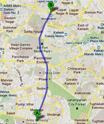
Location of Delhi BRT Corridor on J. B. Tito Marg from Mool Chand to Ambedkar Nagar
A glimpse of the implemented measures on BRT corridor under the experimental trial run is presented in Photo 1 to 9.
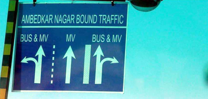
Photo 1: Temporary Overhead signage erected while conducting the Experimental Trial Run
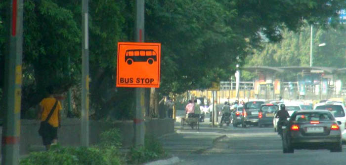
Photo 2: Temporary signage erected for conducting the experimental trial run
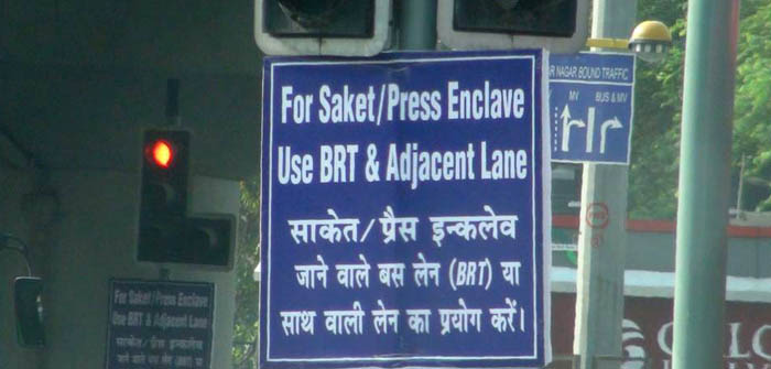
Photo 3: Temporary signage in bilingual language erected while conducting the experimental trial run
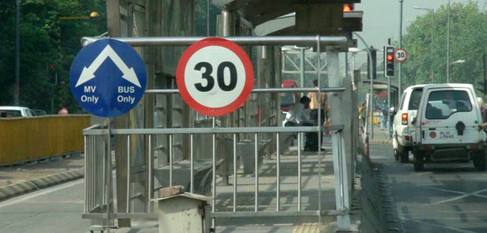
Photo 4: Temporary Regulatory Signage Erected for conducting the Experimental Trial Run
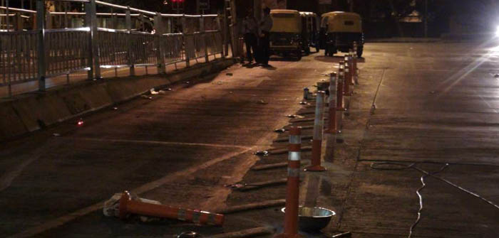
Photo 5: Flexible Bollard Placement in Progress for segregation of Opposing Traffic.
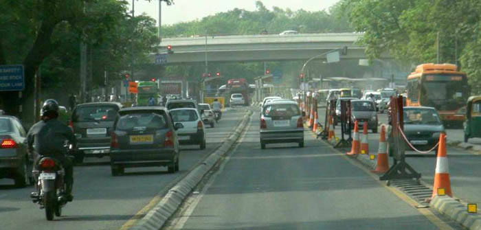
Photo 6: Effective Utilization of available Road Space during the Experimental Trial Run
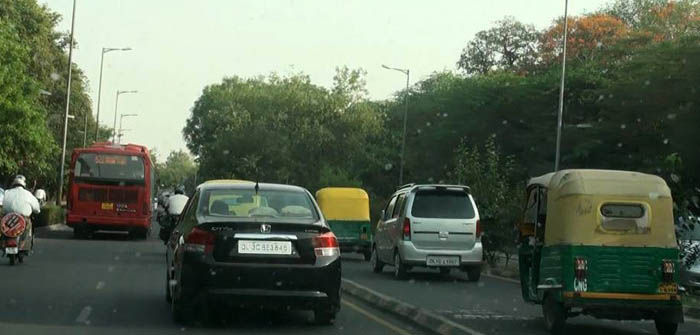
Photo 7: Effective Utilization of available Road Space during the Experimental Trial Run
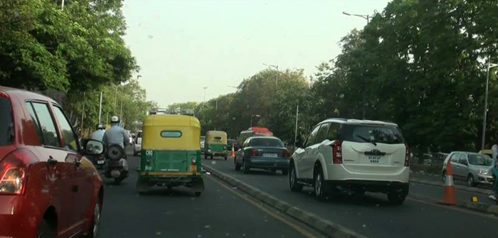
Photo 8: Effective Utilization of available Road Space during the Experimental Trial Run
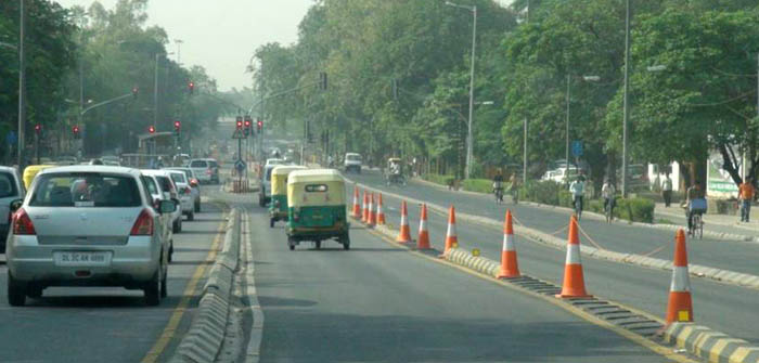
Photo 9: Temporary barricading to control the traffic in Opposite Lanes during the Experimental Trial Run


